"The Southern Ridges comprise a 9-kilometre chain of green, open spaces spanning the rolling hills of Mount Faber Park, Telok Blangah Hill Park and Kent Ridge Park before ending at West Coast Park. It is an area steeped in history and is home to some of nature’s greatest gifts of flora and fauna. It is also one of the best spots in Singapore to catch panoramic views of the city, harbour and the Southern Islands."
caution - depending on where you start and end, it's more than 9km, and need around 3-5 hours to complete. A leisurely pace will require more time... and wear your favourite sportswear...
our plan (most people start from the other way round, then continue from NUS to West Coast Park) i feel this plan is better because the end point is near MRT/Vivo, instead of West Coast.
 Straits Times' article
 Map
Map- SDE/Engineering for Mac
- School of Computing (COM1)
- NUS Business School (BIZ2)
- Prince George's Park Residences (PGPR)
- South Buona Vista Road
- Science Park 1
2. Kent Ridge Park
- Normanton Park
- Vista Park Open Space
- Canopy Walk
3. Telok Blangah Hill Park
- Flora Walk
- Alexandra Arch
- Forest Walk
- Hilltop Walk
- Henderson Waves
4. Mount Faber Park
- Faber Walk
- Jewel Box
- Marang Trail
- Harbourfront MRT
we started at NUS, planning to have breakfast at Faculty of Engineering's McD. But when we reached, McD was closed! The opening hours was 0800 to 2200 hrs, yet it's still closed at 0830! The rest of the canteens were closed too. Shit...
since i'm familiar with the campus, we passed through Central Library, Computing and Business blocks until BIZ2, where we walked along Research Link to PGPR. Luckily there was food at the canteen there, so i loaded myself with food first. Note for readers, Computing requires card access - use the pavement outside Computing for public visitors.
the walk from NUS through Science Park 1 to Normanton Park is rather boring though. The attractions starts from Canopy Walk...
 Out early in the morning...
 PGPR
PGPR Comfortable living for NUS students
 After NUS, Science Park 1
 Strange building - No 18
 HUDC estate - Normanton Park
 Kent Ridge Park - pond
 Towards the Look-out point in KRP
 Look out point
  Nice tree in KRP
 Canopy Walk
 Still on Canopy Walk; looking down to Hort Park
 The winding connector from Canopy Walk (if you jump down)
got lost here. For those exiting Canopy Walk, do not walk down towards Carpark C and D. Once you follow it, you'll end up on Pepys Road (then Pasir Panjang Road). Instead, turn right from the exit and find a small concrete path to the area below Canopy Walk.
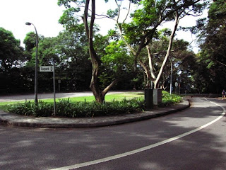 If you walked here, you're lost...
 Reflections of Bukit Chandu
 Getting back on track to HortPark
 At HortPark
 Flowers!
 Nice leaves and flowers
 Glasshouse Design
 Glasshouse 5 and 6
 Glasshouse 3
 Resting area
 Seed Garden - seeds in capsules
 LIAS - baby prams in horticulture?
 AIRCON!
 Exiting HortPark, going to Alexandra Arch
 Across Alexandra Road, of course
 Forest Walk
 Steel is the main material here
 Looking back to Pasir Panjang
 Going higher into the secondary forest of Telok Blangah Hill...
 Approaching the Henderson Waves...
 Crowded with people...
 Looking down - Henderson Road
 The other side of Henderson - DSTA, Depot Road
 Nice woooood
 Can you find this?
 Faber Walk - going to finish soon!
 Over looking Telok Blangah
 Jewel Box
 Seriously, i don't know there's such a place...
 Another viewing area at Faber
 ENDING - Marang Trail
 Out of the trail to...
 Harbourfront!
No comments:
Post a Comment